The 2022 IGS Datum Modernization of the NSRS


The current version, SPCS 83, is used to facilitate NAD 83 and consists of 125 zones based on the Lambert Conformal Conic, Transverse Mercator, and Oblique Mercator projections. Because of the replacement of NAD 83, the SPCS 83 will also be replaced by the State Plane Coordinate System of 2022 (SPCS2022). According to NOAA, as part of this transition, NGS is working with the National Society of Professional Surveyors (NSPS) and the American Association for Geodetic Surveying (AAGS) to draft a statute template that states may use in updating their statutes.
Because of this, it is critical for professional land surveyors and geospatial professionals to review the State Plane Coordinate System of 2022 (SPCS2022) requirements. These policy documents and forms, found on the NGS website, give the requirements for developing the new system, as well as contact information and instructions for requesting future SPCS2022 zones.
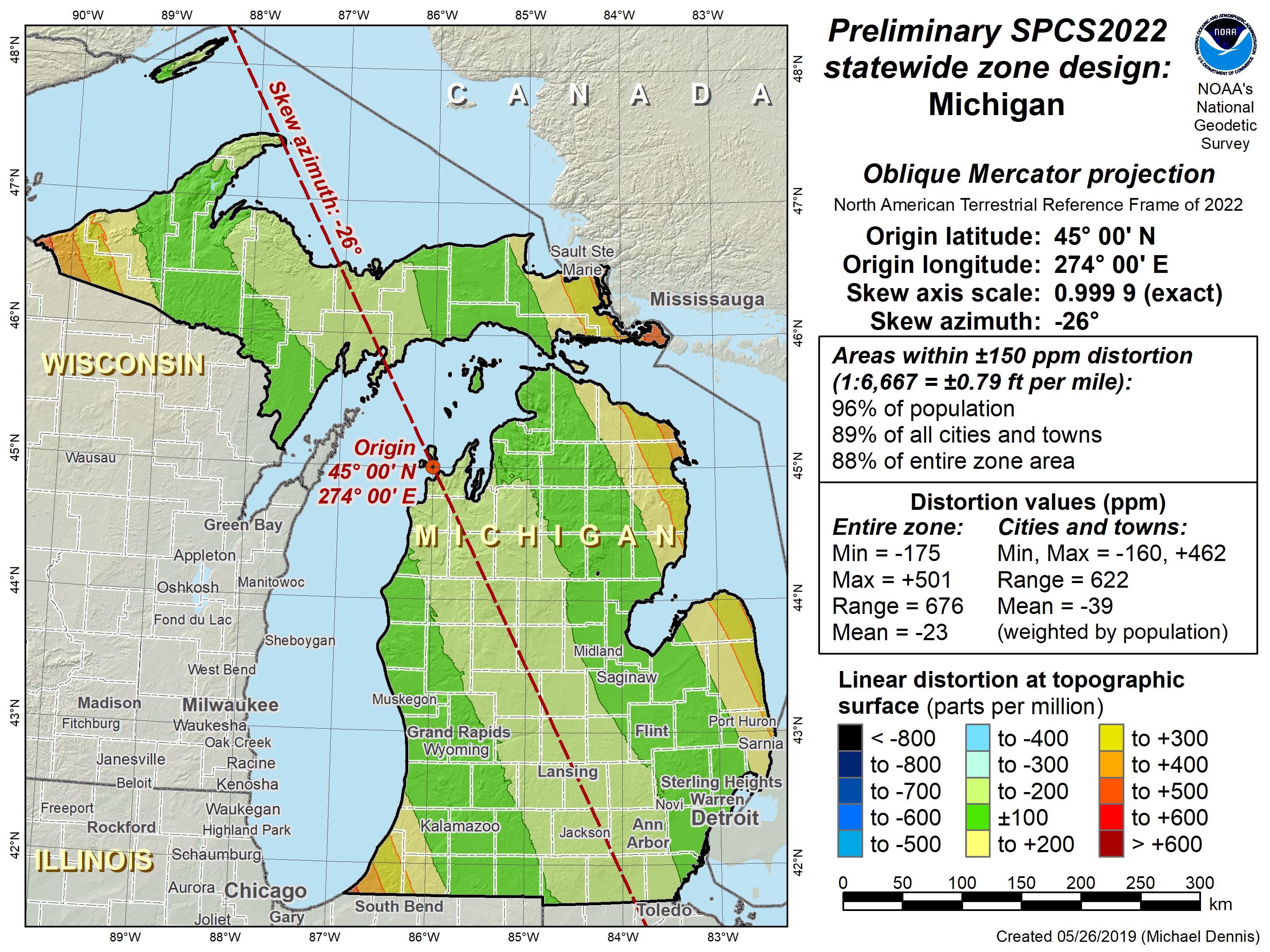
Image excerpted from the National Geodetic Survey website
An example of a preliminary SPCS2022 statewide zone design for the state of Michigan
Lastly, surveyors should prepare for the updating of legislation as it’s required. The National Society of Professional Surveyors (NSPS), the American Association of Geodetic Surveying (AAGS), and the NGS created template legislation to aid states in their transitioning of legislation to new wording. Users can and should contact any of these organizations or local state affiliates for more information.
Conclusion
The National Geodetic Survey (NGS) has embarked on a 10-year process of removing inaccuracies in the existing datums of the United States. The National Spatial Reference System (NSRS) will be accessed using GPS technologies that reference Continuously Operating Reference Stations (CORS) and rely on a time-dependent gravimetric geoid model. According to the NGS, this method of accessing the NSRS will be a paradigm shift from accessing NAD 83 and NAVD 88 through the use of geodetic survey monuments that are unreliable and in danger of removal. By better tracking the dynamic nature of the Earth, and accounting for its ever-shifting status, NGS will provide a tool that is both useful and fluid for the surveyors and geospatial professionals of today.
Sources
- NGS (2008). The National Geodetic Survey Ten-Year Plan, Mission, Vision and Strategy, 2008- 2018
- National Geodetic Survey, 2013: The National Geodetic Survey Ten-Year Strategic Plan, 2013-2023
- Stone, William A, and Dana J Caccamise . “Pathway to 2022: The Ongoing Modernization of the United States National Spatial Reference System.” National Geodetic Survey, National Geodetic Survey, 2017
- National Geodetic Survey 2017: NOAA Technical Report NOS NGS 62 Blueprint for 2022, Part 1: Geometric Coordinates
- National Geodetic Survey, 2017: NOAA Technical Report NOS NGS 64 Blueprint for 2022, Part 1: Geometric Coordinates
- National Geodetic Survey, 2019: NOAA Technical Report NOS NGS 67 Blueprint for 2022, Part 3: Working in the Modernized NSRS
- Wang, Y.M., D.R. Roman (2004). Accuracy Estimation of NGS Geoid Model USGG03 and GEOID03, Presented at AGU 2004 Fall Meeting, San Francisco.
Alexis Brumm is an experienced magazine editor with familiarity in various construction industries, including heavy construction, drilling, surveying, geospatial, and the crane and lift industries. www.linkedin.com/in/alexis-brumm-b3a82732

|
