Photogrammetry vs. LiDAR: Applying the Best Technology for the Job


LiDAR & Photogrammetry Hybrid Usage Cases
If you’re wondering why LiDAR and aerial imagery are not collected together on most projects, you aren’t alone. This is an all-too common question among land surveyors and geospatial professionals that only reinforces why it is important to understand the depth of the two technologies.
If LiDAR and photogrammetry methods are collected together, it would seem to save considerable money during the collection. Only one aerial platform would be mobilized to the site and total flying time over the project would be reduced. Flying has certainly become more expensive with today’s fuel prices and the significant increases in insurance premiums for most aircraft after 9/11. Additionally, flying with two sensors requires two holes in the floor of the aircraft. Several platforms flown by aerial acquisition firms today have that capability. However, the challenges or issues with simultaneous collection generally preclude its application on most projects.
Aerial photography depends on the sun to provide illumination of the ground for the imagery collection. Therefore, aerial cameras are known as passive sensors. Conversely, LiDAR is an active sensor. The laser is used to illuminate the ground. Because of this, LiDAR can be flown 24 hours a day. In fact, the majority of our LiDAR acquisition takes place outside the normal window for aerial photo collection. For a couple of our recent projects flown in the vicinity of Atlanta and Newark airports, collection at night when commercial air traffic was at a minimum was the only real option for data collection. In general terms, trying to collect the imagery and LiDAR together would result in a loss of anywhere from 21 to 16 hours (depending on the time of the season and the span of appropriate sun angles for imagery collection) of otherwise perfect collection time for LiDAR. When flying sensors that generally cost $1 million or more, it is important to maximize their use to keep unit costs down.
Secondly, the flying heights necessary for imagery and LiDAR collection are often different. Most LiDAR collection for 2-foot contour mapping is flown around 5,000 to 5,500 feet above ground. Two-foot contours are most often paired with 100' scale planimetric mapping and digital orthophotos at a 0.5-foot resolution or ground sample distance (GSD). Imagery collection to provide this resolution and planimetric accuracy is generally flown around 4,200 feet above ground. Moreover, the line spacing between parallel flight lines flown back and forth over a project is very different for LiDAR and imagery collection. At 4,200 feet above ground, the line spacing for imagery collection (assuming a typical large format camera) is 4,410 feet. At 5,000 feet above ground with a 30-degree field of view, the line spacing for LiDAR collection is about 1,900 feet. Similar arguments could be made for 1-foot contours paired with 50' scale mapping and 0.25-foot GSD orthophotos. The significant differences in flying height and line spacing provide a real challenge for simultaneous collection.
LiDAR and aerial photography, separately collected, generally provide a perfect complement for most mapping projects. The strength of LiDAR, namely the ability to place a large number of mass points on the ground in a very accurate fashion, works very well with the strengths of photography. Photography provides mapping professionals with the ability to collect accurate planimetric features and serves as the base for the creation of digital orthophotos, or accurate image-based maps. Improvements in LiDAR sensor technology and related software enhancements may transfer more of the mapping capabilities toward the LiDAR sensor. But for the foreseeable future, aerial photography will continue to serve an important role in most mapping projects.
Below are two usage case examples where combinations of photogrammetry, LiDAR were used in combination with other technology.
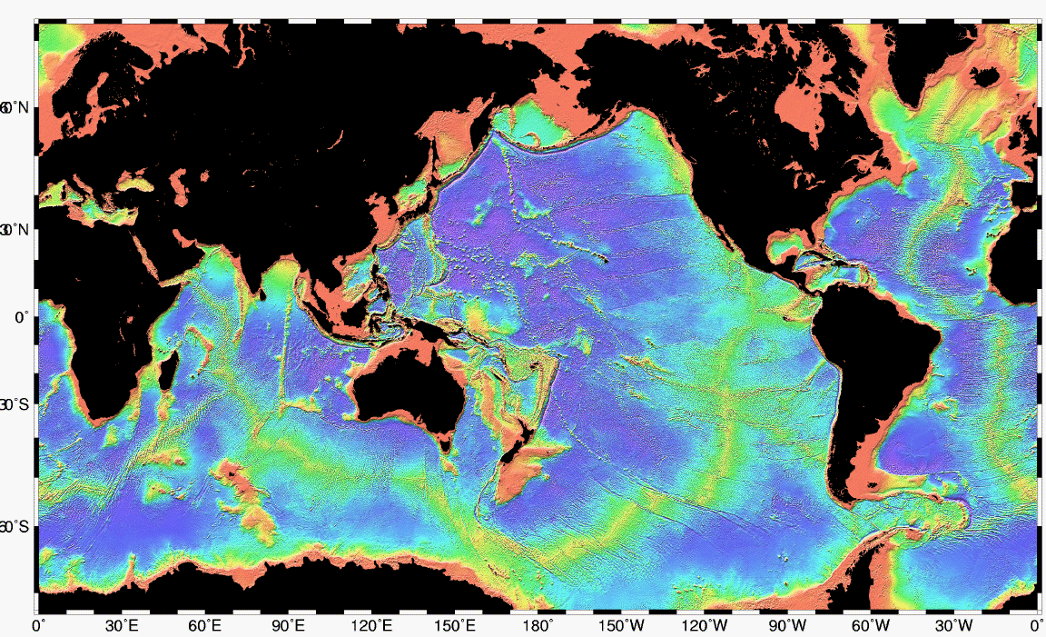
Source: en.wikipedia.org/wiki/Bathymetry
Bathymetry of the ocean floor showing the continental shelves (red) and the mid-ocean ridges (yellow-green).
#1. Airborne LiDAR Bathymetry
Bathymetry is the study of the seabeds or floors of water bodies, whether these water bodies are oceans, rivers, streams or lakes. Bathymetry not only checks for the depth of seabeds and water body floors; it can also bounce off of objects and derive underwater topography, the locations of objects, and even the sub-surface features of seabeds, or lake or river bottoms. Bathymetry commonly makes these measurements by using techniques such as single-beam or multi-beam echo sounders that are mounted on a boat. These sounder units emit sound waves that bounce off the underwater surfaces.
But there are also times when bathymetry in itself isn’t able to obtain the measurements needed from underwater surfaces, like when water access is complicated.
One workaround is to use an airborne vehicle such as a drone (UAV) that is equipped with LiDAR. The LiDAR system works in tandem with the echo sounder that is on a boat in the water. Collectively, the LiDAR and the bathymetry echo sounder capture relevant data. Then the LiDAR unit on the drone communicates with the echo sounder on the ground. In these instances, the echo sounder is placed in the water, the drone with LiDAR descends to a predetermined hover point and a measurement is taken. The drone then moves to the next point of measurement.
The data collected creates an array of points that map the sea floor under the body of water. Increasingly, this technique is being used with drones that work in concert with onboard multi-beam scanners, as the drones are more agile and less expensive to deploy than planes.
#2. Combining Photogrammetry and LiDAR to Create A Geospatial Map
There are times when practicality, cost and the project being surveyed or mapped combine to make a strong argument for a hybrid mapping combination of photogrammetry and LiDAR technologies.
The mapping is accomplished by combining data from Photogrammetry DIM (dense image matching point clouds) with data from LiDAR in the development of a final geospatial map. For this reason, most new generation airborne LiDAR systems integrate a LiDAR unit and a single-camera or multi camera photogrammetry cameras in the same platform. The geospatial mapping software is the integration point for photogrammetry and LiDAR.
Summary Remarks On LiDAR vs. Photogrammetry
Both photogrammetry and LiDAR are indispensable surveying and measurement technologies that can be used in a plethora of use cases. In many ways, the two technologies overlap each other in the data that they capture. However, the demands of the project being surveyed or documented and the costs involved often determine which technology is chosen.
The cost of LiDAR has fallen, but it is still more expensive than traditional photogrammetry. On the other hand, there are limits to what photogrammetry can do. You can't look at sub-surface elements of a structure, for example; or get a clear picture of the ground when you have to work through smoke or cloud cover.
There are also cases where the best of breed solution for a given project is a combination of photogrammetry and LiDAR. In these cases, the output from each technology can be consolidated with the help of geospatial mapping software.
Regardless of the type of technology employed, the most important takeaway for practitioners is that they have a choice in the technologies used to obtain desired results.
Sources
National Ocean Service, What is LiDAR
GIS Geography, What is Photogrammetry, July 3, 2020
Skagit County, Washington Geographic Information Services, August 3, 2020
enginering.com, Photogrammetry Explained: The State of Reality Capture, Andrew Wheeler, October 5, 2016
tested.com, Brandon Blizard, February 9, 2014
Encyclopedia Britannica, Eric Gregerson
BCC Research, “Light Detection and Ranging (LiDAR): Technologies and Global Markets” by Sinha G. Gaurav., March 20, 2018
LiDar-uk.com, How Does LiDar Work
DLT, How Do You Process LiDar Data?, June 13, 2014
Esri, Arcgis Website, What is a LAS data set?
NASA Scientific Visualization Studio, Flying through LiDar Canopy Data, Alex Kekesi, June 12, 2018
National Ocean Service, What is Bathymetry?
GIS Resources, Most Common Business Uses of Photogrammetry, Wendy Dessler
Interesting Engineering Website, 11 Incredible Engineering-Related Applications for Photogrammetry, Chris Young, May 24, 2020
POB Magazine, From The Ground Up: LiDAR and photogrammetry
State of Wyoming Department of Transportation Website, Photogrammatic Surveys
Spec Drones Website
U.S. National Institute of Health Website, Assessment of he Possibility of Using Unmanned Aerial Vehicle (UAVs) for the Documentation of Hiking Trails in Alpine Areas, Paweł Ćwiąkała, Rafał Kocierz, Edyta Puniach, Michał Nędzka, Karolina Mamczarz, Witold Niewiem, and Paweł Wiącek, Dec. 29, 2017
American Geosciences Institute, What is LiDar and What is it Used for? National Oceanic and Atmospheric Administration
Lidar News, In the Scan Lidar News Blog, March 2, 2020
Cambridge University Press, Annals of Glaciology, Volume 54, Issue 63, Ice-volume changes, bias estimation of mass-balance measurements and changes in subglacial lakes derived by lidar mapping of the surface of Icelandic glaciers, Tómas Jóhannesson, Helgi Björnsson, Eyjólfur Magnússon, Sverrir Guðmundsson, Finnur Páls-son, Oddur Sigurðsson, Thorsteinn Thorsteinsson and Etienne Berthier, 2013
GIM International Website, When Photogrammetry Meets Lidar: Towards the Airborne Hybrid Era, Isabella Toschi, Fabio Remondino, Tobias Hauck, Konrad Wenzel, September 13, 2019
Mary E. Shacklett is President of Transworld Data, a technology analytics, market research and consulting firm. She is a former technology executive, and a noted technology analyst and commentator who is engaged with land- and water-based geospatial technologies. Mary is listed in Who’s Who Worldwide and in Who’s Who in the Computer Industry. She may be be reached at mshacklett@twdtransworld.com

|
