Photogrammetry vs. LiDAR: Applying the Best Technology for the Job


Photogrammetry Use Cases
Below are seven photogrammetry usage cases that illustrate the range of the technology’s methodologies:
Excerpted from interestingengineering.com/11-incredible-engineering-related-applications-for-photogrammetry
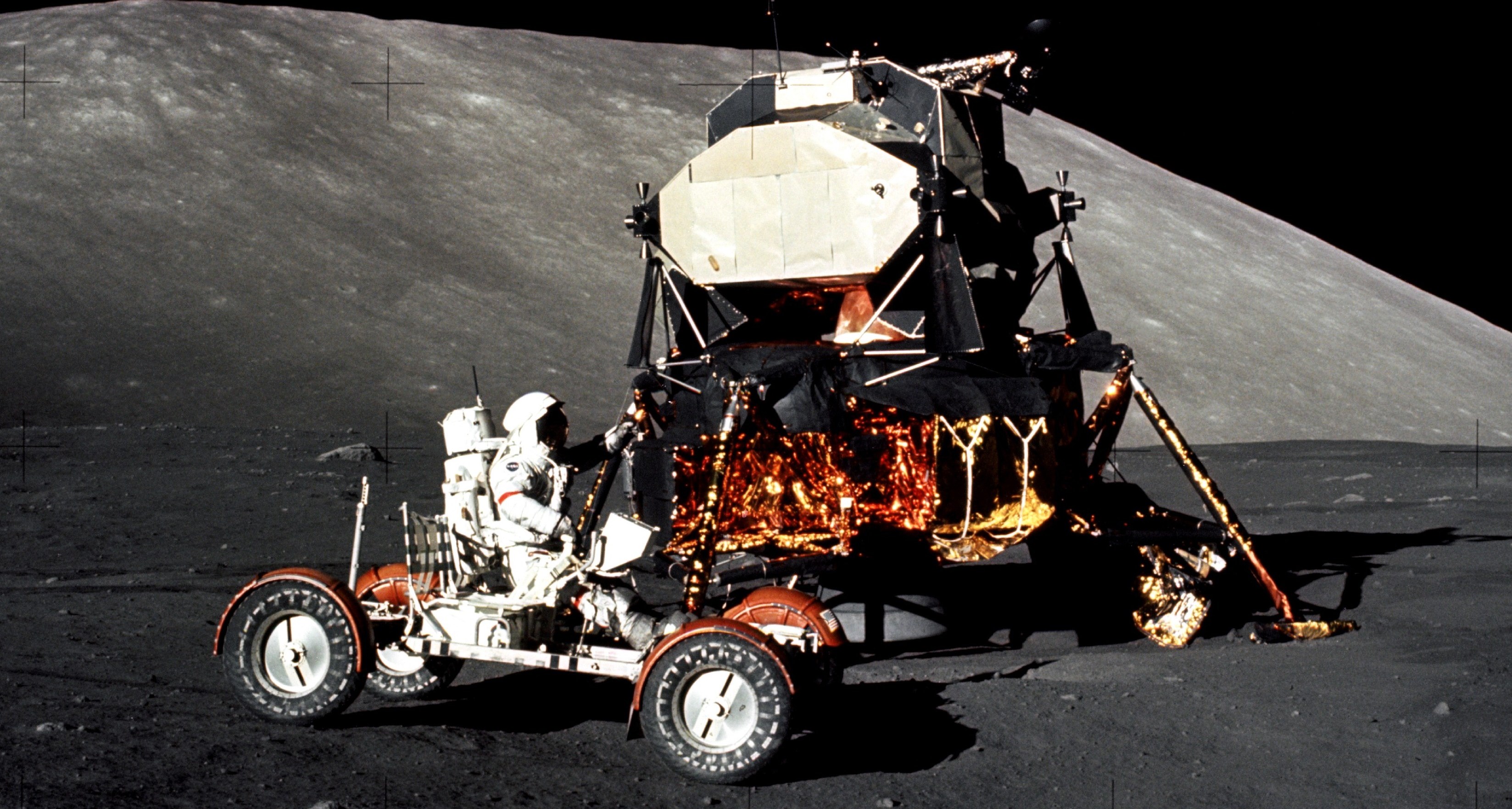
Photograph of NASA Lunar Roving Vehicle. When Damage was incurred to the rearward extension of the vehicle during the Apollo 17 mission, support crews on earth were able to fabricate a solution with the help of photogrammetry images and mapping.
#1. Apollo 17 Equipment Repair
During the Apollo 17 Moon landing, astronaut Gene Cernan accidentally caught the hammer he had stored in his calf pocket under the right rear fender of the Lunar Roving Vehicle, and tore off the rearward extension.
By using photogrammetry, the Apollo 17 crew was able to capture photographs of the damaged part and send them back to support personnel in Houston. The support personnel helped design a replacement for the fender by using tape, some spare clamps and a lunar landing site map that was created by applying photogrammetry techniques to satellite images.
This was a valuable lesson learned. NASA continues to use photogrammetry to carry out 4D photogrammetric analyses, single image quantitative analysis, and other techniques as part of its operations. These techniques are applied in order to analyze equipment so that satellites continue to work without interruption. Photogrammetry surveillance also helps astronauts stay safe on the launch pad.
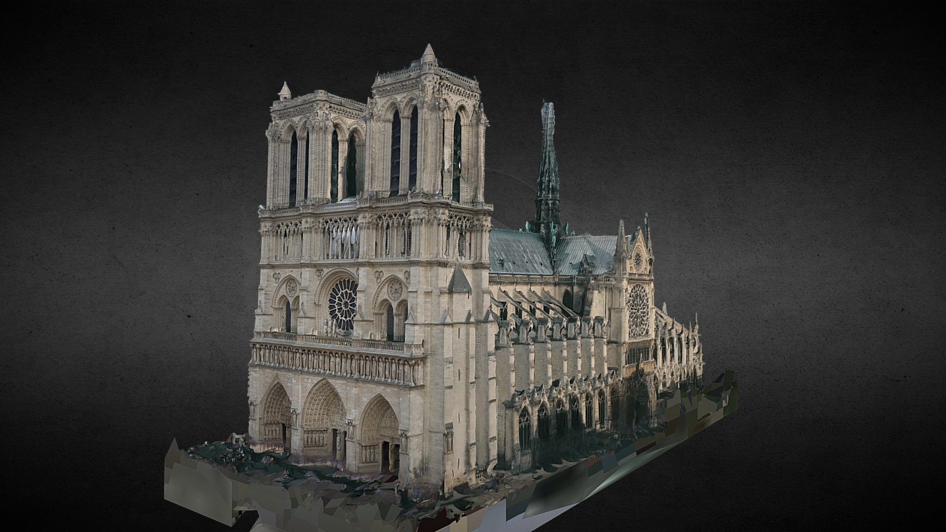
Photo by Art Graphique et Patrimoine
The day after the catastrophic Notre Dame fire, the French government turned to Art Graphique et Patrimoine for help and asked the company to draw on its archives to build a digital version of Notre Dame as it had been before parts turned to ashes.
#2. Restoration at the Notre-Dame de Paris cathedral
After a damaging fire burned down portions of Paris’ Notre Dame Cathedral in April 2019, the jobs of surveying the damage and developing a restoration plan for the structure began.
Millions of mapping datasets were generated and photogrammetry scans were taken of the cathedral and how it had appeared over the course of several years before the fire occurred. The cathedral was also scanned as it appeared after the fire to help assess damage.
This foundational work in photogrammetry is instrumental in the reengineering and ongoing restoration of Notre-Dame de Paris cathedral.
#3. Land Surveying in Wyoming
Photogrammetry is heavily used in land surveying and capably captures the terrain of rural, suburban and urban areas, and even water.
The Wyoming Department of Transportation uses photogrammetry to produce land surveys from around the state. The photogrammetric projects are performed with a small Cessna plane that is equipped with a digital imaging system. This unit contains an operator display, eight individual cameras, a solid drive storage unit for images, and an inertial measurement unit that coordinates with the onboard GPS system to assist with triangulation and accuracy.
A flight plan is developed based upon the type of land being surveyed. For example, an urban survey project might use a flight path at 1,250 feet. On the other hand, a rural land survey might be at conducted at 2,000 feet, and a high altitude city planning project might take place at a height of 9,500 feet. Project adjustments are also made for pixel resolutions and the amount of area to be covered. Finally, adjustments are made for weather conditions.
These mission planning parameters are then loaded into the photogrammetry software. The parameters will be referenced whenever photogrammetry images from the flight are imported into the software.
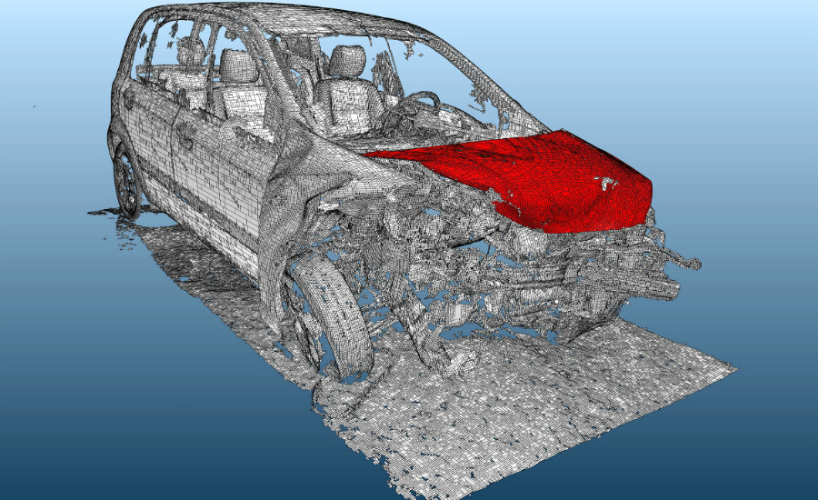
Photo by Arithmetica
An accident scene reconstructed using photogrammetry.
#4. Evaluating Crime Scenes & Accidents
Photogrammetry can also be used in traffic accident and crime scene documentation, including:
- Crush measurement on damaged vehicles
- Skid mark measurement
- Bullet trajectory determination
- Shoe and tire print scanning
- Blood spatter measurement
- Suspect height recovery
- Accident and crime scene mapping and diagramming
All are areas where it is advantageous to have an accurate 3D reconstruction of an event, especially where position, distance and perspective are important.
Documenting a traffic accident with the help of a drone and photogrammetry camera(s) can quickly clear an accident site and unclog traffic, since on the ground inspectors and documenters no longer have to spend hours at the site. In crime scene documentation, photogrammetric renderings of the scene are also helpful, because objects can be moved and photogrammetric image capture is an effective way to document and preserve positions, distance, etc.
In a usage case example, a trip and fall accident on a playground occurred when a woman claimed she had tripped and fallen as she was mounting some steps because of an irregularity in the nearby pavement. The defense argued that the irregularity in the pavement was too far away from the steps to have caused the claimant to trip and fall. Photogrammetry of the area played a key role in resolving the dispute.
#5. Virtual Real Estate Tours
Real estate agents are using photogrammetry and 3D dimensioning on websites to assist prospective buyers with virtual “looks” or tours of properties.
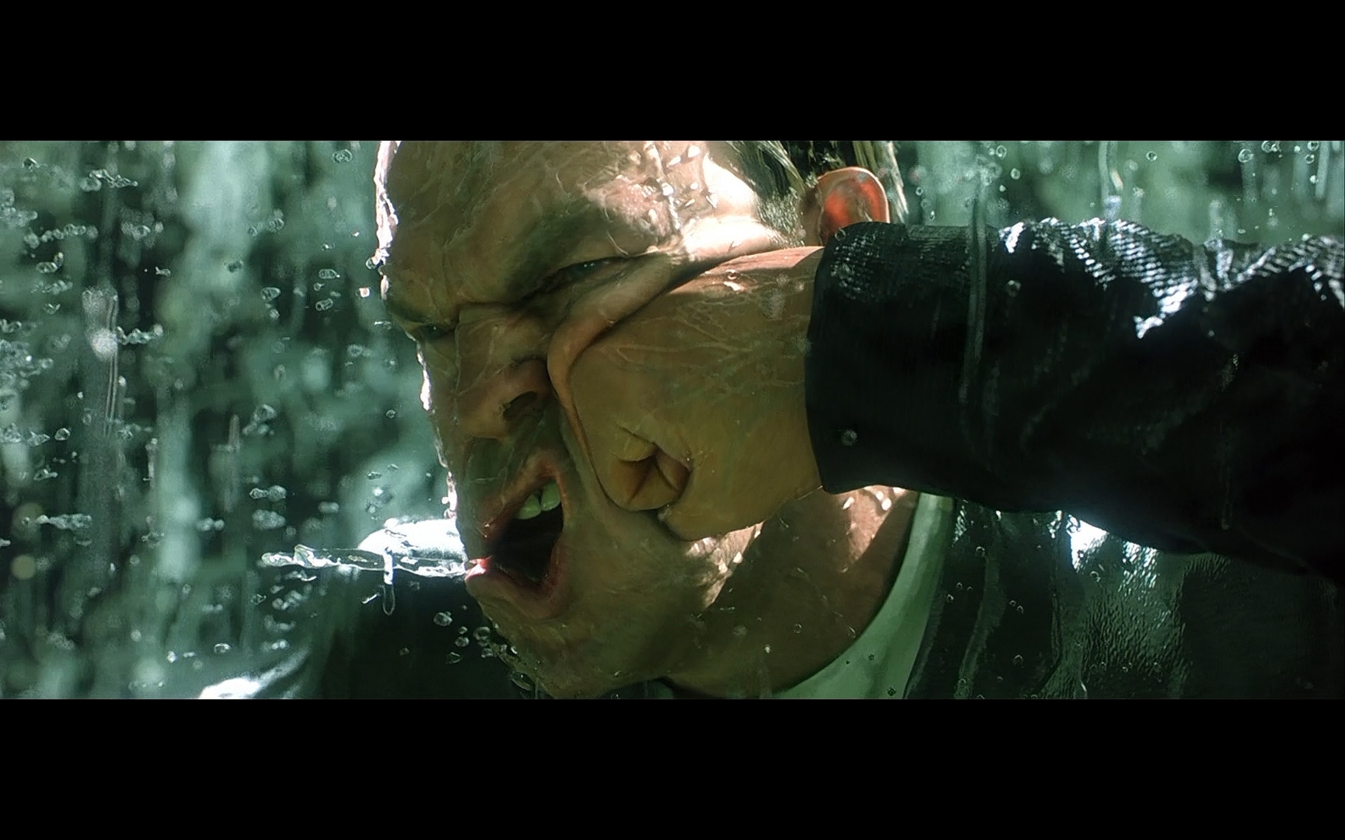
Still taken from the film, Matrix Revolutions
In Matrix Revolutions, a photogrammetry setup was used to capture the 3D likeness and movements of the actors, enabling the filmmakers to bring the intensity of this punch to life.
Excerpted from: pixellighteffects.com/why-use-photogrammetry
An interior photogrammetry camera setup must capture a 3D object from every angle, with overlap between photographs.
#6. 3D Modeling Using Photogrammetry in Film and Entertainment
With the help of photogrammetry, movie set builders have more flexibility for designing sets. They can use 3D models to test the sets they design before actual filming takes place. Photogrammetry is also widely used in the development of video games to create photo-realistic scenes.
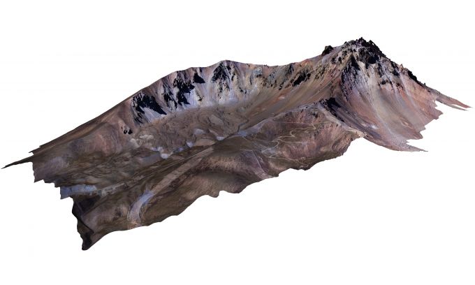
Mount Erciyes
#7. Mapping Central Turkey’s Mount Erciyes
In high mountain areas, there is constant risk of falling rocks, landslides, avalanches and other hazards for hikers. Being able to regularly photograph these difficult to access areas with the help of photogrammetry ensures that park officials and others in charge of trail safety have the latest information for those visiting and using the trails.
Photogrammetry can be deployed on a satellite or on a plane or even on an unmanned aerial vehicle (UAV) such as a drone. These methods enable the capture of high-resolution digital surface photos that can be produced at a reasonable cost.
One use case for this methodology is the photogrammetric photographing and mapping that was conducted at the remote Mount Erciyes in Central Turkey. With the help of aerial photogrammetry, officials were able to map the mountain and the trails that traversed them.
